P 1 (Asticou) to Lac Pink
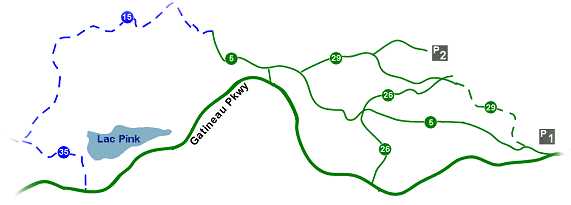
Trails # 5 (green), # 15 (blue), and # 35 (blue) in the Gatineau Park. Trail # 5 is a shared trail for both skate and classic cross-country skiing, while # 15 and # 23 are only for classic skiing. Total distance (there and back) is about 12 to 13 kilometres. ( scroll down for photos )
The P1 Parking Lot is located in the back of the federal government's large language training center at Asticou. Trail # 5 is a little hilly at first, but after a while, it flattens out and becomes a very easy trail with lots of open fields. It is a nice change for people who are used to skiing in the wooded areas of the Park. This area may also be ideal for individuals who are just learning to cross-country ski. One problem with this part of the trail is that it is sometimes plagued by dog-walkers, etc (and they seem oblivious to the fact that people are not supposed to walk on the ski trails).
At the end of trail # 5 you come to trail # 15. There's a lot of hill climbing when heading towards Lac Pink (and vice versa when heading back). It's a nice and twisty trail in a forested area, and the # 15 is not too difficult by blue trail standards. Nevertheless, there are a few challenging hills, especially at the beginning where trail # 15 meets trail # 5. Continuing on trail # 15 means you will eventually arrive at an intersection for trail # 35. Here you turn left for a short downhill leg to Lac Pink.
Trails # 15 and # 35 do have some fairly large hills and may be a bit too difficult for beginners. As an alternative, as you approach the last leg of trail # 5, you may want to cross over to the Gatineau Parkway. The trail on the Parkway here is located on what is a paved park road during the summer. It is wide with plenty of space for both skate and classic cross-country skiing. You will still go up some hills to get to Lac Pink, but on the Parkway, these are long gradual slopes, and they are much easier to climb or descend.
|
(Click on the map for a larger view of the surrounding area of the park.)

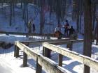
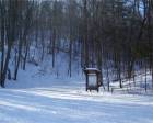
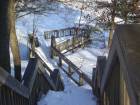
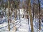
(Photos from this trail - click on the images for larger pictures )
Photo(s) and web page, © Michael McGoldrick, 2006.
[ Return to Home Page ]
JAlbum 5.1
|