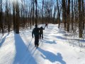
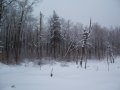
Cross-
Country
Ski Photos
(click on the photos
for larger images)
|
|

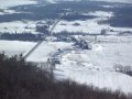
 Gatineau Park Maps Gatineau Park Maps
Maps of some xc-ski trails in different sections of the Gatineau Park.
|
 GreenBelt Map GreenBelt Map
A map of some xc-ski trails in the Greenbelt in west-end Ottawa.
|
|
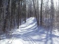
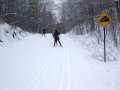
The Gatineau Park - Information and Photos of Various Trails and Routes
|
 Trail Blazers - some history about XC skiing in the Gatineau Park. Trail Blazers - some history about XC skiing in the Gatineau Park.
Background information about cross-country skiing in the Gatineau Park.
P10 to Keogan/Huron - the Fortune Parkway & trail # 1 (green)- 7 to 10 km.
P8 to P9 on the Gatineau Parkway (green) - about 7 to 7.5 kilometres.
P7 to Keogan - Trails # 30 (blue) and # 1 (green) about 8 to 9 kilometres.
P6 to Lac Pink - trail # 7, the Gatineau Parkway, and trail # 35 - 8 to 9 km.
P16 to Herridge (& Healey) -
trail # 50 (green) - total distance is 9 to 10 km.
P 1 (Asticou) to Lac Pink - trails # 5, # 15, and # 35 - about 12 to 13 km.
P 11- trail # 36 to trail # 50 - (blue) - total distance is about 14 kilometres.
P10 to Huron - via trail # 3 (blue) & the Fortune Parkway (green) - 14 km.
P12 to Western - trails # 40 (blue), # 33 (blue), and # 2 (blue) - 10 km.
P12 to Huron - trails # 40, # 33, # 1B, and # 1 - a little over 11 kilometres.
P12 to McKinstry trails # 40 (blue), # 24 (green), and # 1 (green) - 20 km.
P19 to Lac Talyor - trails # 50 (green) and # 55 (green & blue) - 12 to 13 km.
P19 to Lac Lusk - trails # 50, # 55,and # 54 - about 9 to 10 kilometres.
P17 to Renaud - trails # 52 (blue), # 50 (green) # 53 (green) - 27 to 28 km.
P7 to Keogan via more difficult trails - including trails # 6 & # 34
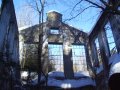
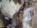
Skiing to the Carbide-Willson Ruins - located off trail #36 about 1 km P 11.
Skiing to the Lusk Caves - located approximately 1 km south of trail # 50.
P6 Hiking/Walking Trail - the Lauriault Trail - about 3 kilometres.
|
| |


